Transportation Engineering
We take pride in positively impacting lives through our engineering work. Our expertise ranges from Master Transportation Planning, where we work with stakeholders to develop longer-term network-wide goals and implementation strategies, to Transportation Impact Assessments, where we focus on more localized solutions. We use our technical expertise in travel demand forecasting, traffic and pedestrian micro-simulation modelling, signal timing, data collection, noise abatement, and more, to provide customized solutions.
Public Projects

Beaumont Intersection Management Guidelines
The City of Beaumont has a population of over 18,000 residents and is a member municipality of the Edmonton Metropolitan Region Board. The city has experienced significant changes to its road network including the addition of arterial roadways and changing traffic volumes and patterns.
Our team produced Intersection Management Guidelines to provide a foundation for ongoing work related to the management of transportation infrastructure in the city. We created a framework to identify intersections for signalization and established guidelines for the implementation of signal phasing, a traffic monitoring program, and different signal timing plans.
Private Projects
Calgary Event Centre 2021 Transportation Impact Assessment & Preliminary Event Management Planning
The new Calgary Event Centre will be a multi-purpose venue with 19,000 seats to house the Calgary Flames and host concerts and events, along with ancillary commercial uses, outdoor plazas, and other amenities.
Our team undertook extensive traffic and pedestrian simulation modelling to assess pre and post-event conditions and to provide benchmarks for managing capacity and congestion. The modelling was one of many inputs for building design evolution and roadway and pedestrian facility planning.
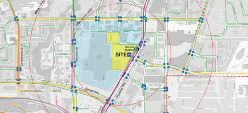
Coquitlam Centre Unlimited Master Plan Transportation
Assessment
Coquitlam Centre Unlimited is a master-planned development that required a Transportation Impact Assessment to support the Phase 1 rezoning application.
Our team reviewed the current transportation networks in the vicinity of the proposed development site, along with the relevant policies of the City. The study outlined the future road network proposed for the Phase 1 development and the Master Plan build-out, including the site’s vehicle access locations.
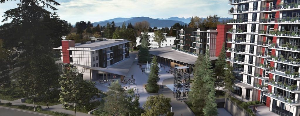 Image Source: Musqueam Capital Corporation
Lelem Village Master Plan
Lelem is a 21.44-acre master-planned community in Vancouver, BC, within the University Endowment Lands fronting University Boulevard to the northwest of the University Golf Club.
Our team reviewed the study area’s travel characteristics, planning policies, neighbouring development plans, and future vehicle projections of the street network considering background traffic growth and vehicle movements.

Nelson Street Towers Transportation Impact Assessment & Parking Study
Tree House and Light House are proposed mid-rise mixed-use buildings on Nelson Street in Esquimalt, BC.
Our team studied the existing transportation network operations to confirm the adequacy to accommodate the proposed development. We also assessed the appropriateness of residential, visitor, and commercial parking variances and identified appropriate supporting Transportation Demand Management measures.
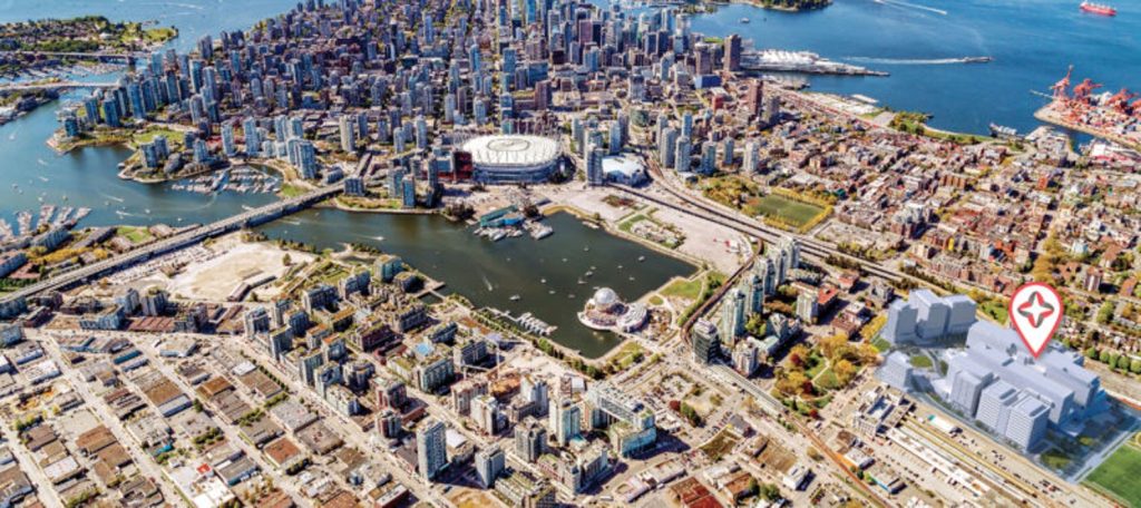 Image Source: Providence Health Care/The New St. Paul’s Hospital
New St Paul’s Hospital Transportation Impact Assessment & Transportation Demand Management Plan
The new $1.9 billion hospital and health campus will offer an integrated care model by blending hospital-based services with primary care and community health services and support programs.
Our team provided design input on the proposed parking, loading, and transportation demand management plans for the new 548-bed hospital. This work formed part of the technical submission for the City of Vancouver’s approval process.
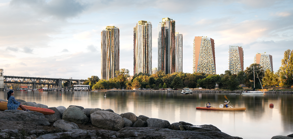 Image Source: Squamish Nation and Nch’kay West
Senakw Master Plan & Construction Traffic Management Plan
Senakw is a highly sustainable, mixed-use project that will provide 6,000 secured purpose-built market and below-market rental homes and 170,000 ft2 of office, retail, and restaurant spaces by 2033.
Our team provided ongoing consultation and master plan design input. We studied the site context, accessibility, project statistics, site access, parking, and loading. Our Construction Traffic Management Plan supported Phase 1 construction.
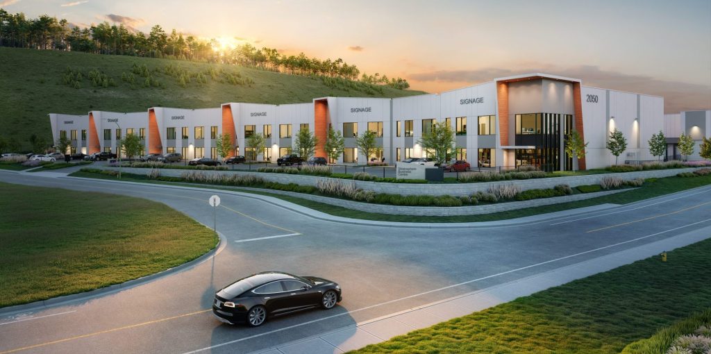 Image Source: Beedie
2050 Pier Mac Way Transportation Review & Secondary Access Review
Stratosphere is a proposed industrial development in Kelowna, BC consisting of two buildings with 13 strata units.
Our team assessed the net change in future site trips compared to what was projected in a previous 2013 study and assessed the feasibility of a proposed inbound-only access. The findings help inform discussions between our client, the future build-to-suit user, the City of Kelowna, and the BC Ministry of Transportation and Infrastructure.
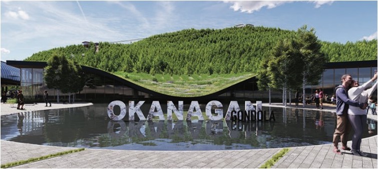 Image Source: Ridge North America
Okanagan Gondola Transportation Impact Assessment
The Okanagan Gondola is a proposed attraction overlooking Kalamalka Lake south of Vernon, BC, featuring walking trails, mountain biking paths, ziplines, restaurants, ancillary retail stores, and event space.
Our team’s work was completed as part of the land use redesignation application process. We analyzed existing transportation conditions and anticipated transportation impacts of the proposed development, reviewed the safety of adjacent intersections, and recommended transportation design and mitigation measures.
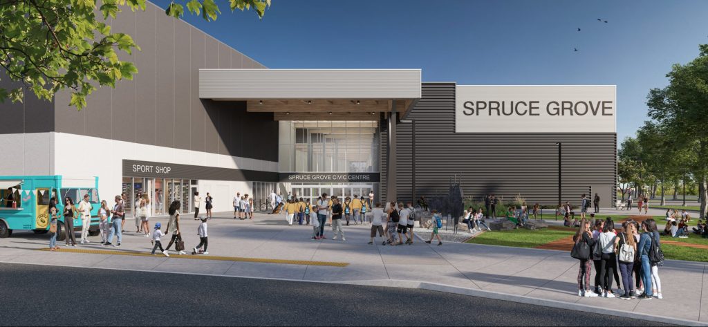 Image Source: GEC Architecture
Spruce Grove Civic Centre Parking Study & Transportation Impact Assessment
This new Civic Centre will include a twin ice arena, library, black box theatre, art gallery, and a transit centre with a park-and-ride lot.
As part of the preliminary design phase of the project, our team confirmed the on-site parking requirements. We also confirmed the site access lane arrangements and traffic control required to accommodate typical PM peak hour traffic volumes and traffic volumes associated with regularly occurring events.
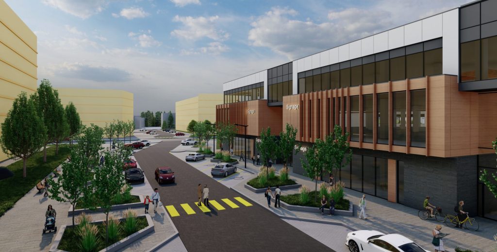 Image Source: Hodgson Schilf Evans Architects Inc.
Millwoods Wellness Community Hub Development Transportation Impact Assessment
The Covenant Wellness Community is a proposed 11.2-acre development that will include a health centre, multigenerational housing, an integrated seniors’ continuing care centre, surgical services, and commercial buildings.
Our team evaluated the transportation network capacity to accommodate the projected demands. We reviewed site access locations and configurations and on-site drive aisle configurations, and we identified opportunities for transportation demand management strategies at the development permit stage.
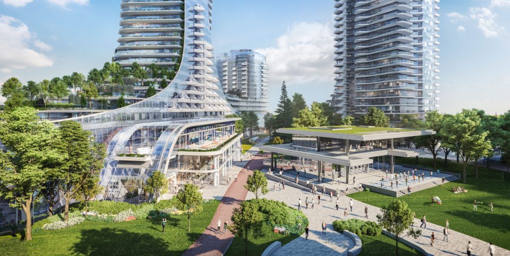 Image Source: Westbank
Oakridge Centre Redevelopment Master Plan
The Oakridge Redevelop is one of the most high-profile and ambitious mixed-use redevelopments in Metro Vancouver and a cornerstone for the entire Municipal Town Centre redevelopment envisioned by the City of Vancouver.
Our team has been involved with Oakridge for several years, from the project rezoning approval by the City of Vancouver in 2014 to the development permit approvals and construction traffic management work today.
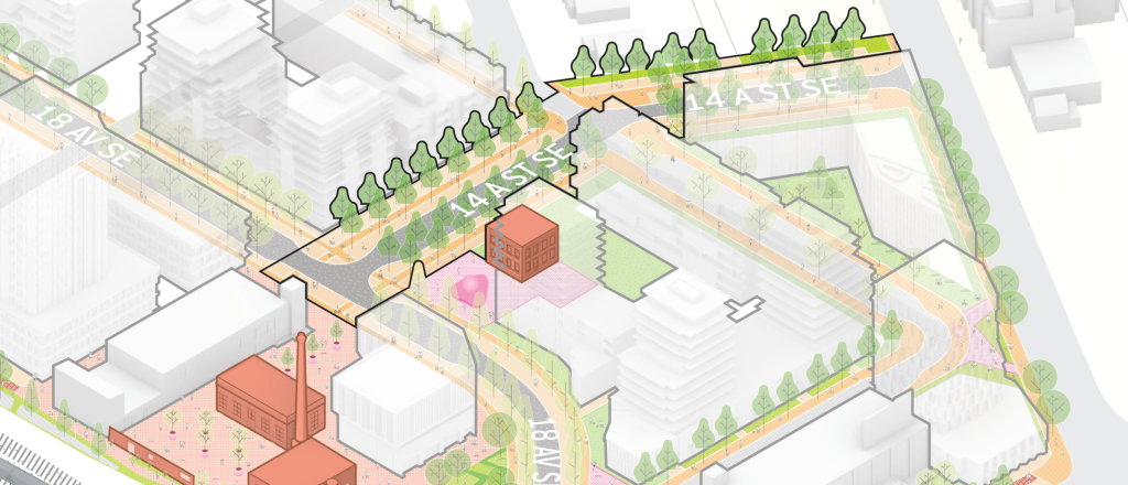 Image Source: CivicWorks
Brewery-Rail District Transportation Impact Assessment & Roadway Design
The Brewery Rail lands are located near the future Ramsay/Inglewood LRT Station and next to the CPKC Railway. A mixed-use site development is proposed for the site and will include 1,750 residential units as well as 600,000 ft2 of commercial space.
A Transportation Impact Assessment was developed by our team for the project. Our work included designing custom public roadway cross-sections and using non-standard public roadway geometry to preserve historical buildings. A new ‘Rail Trail’ next to the CPKC Railway also proposed by our team to provide enhanced cycling/pedestrian connectivity to the future LRT station.
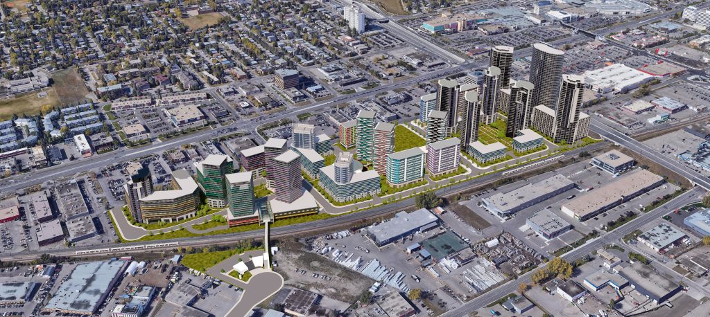 Image Source: IBI Group
Midtown Station Sustainable Transportation Study &
Road Network Conceptual Design
Midtown Station is a 30-acre development in Calgary’s Fairview neighbourhood. The community comprises a mix of high-rise residential towers, townhouses, retail, and commercial space. The development includes a community centre, a new C-Train LRT station, and a potential connection to Calgary’s Plus 15 Skyway network.
Our team developed a VISSIM model of the surrounding road network to identify how to accommodate all modes of transportation traffic. We also reviewed existing C-Train ridership to determine if there was capacity for the increased ridership. Lastly, we prepared conceptual plans for the identified improvements to the road network.
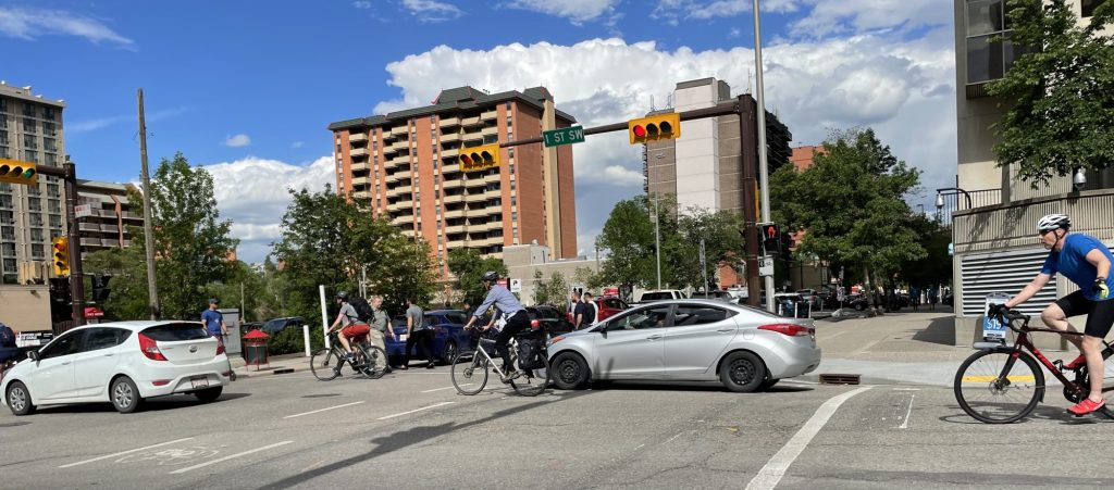
3 Avenue Corridor Cycle Track Operational Review
To maintain cycling connectivity within the Downtown core during Bow River flood barrier construction, the City of Calgary implemented a cycle track detour.
Our team assessed the traffic impact of the cycle track on the corridor and within four large office parkades. A before/after analysis was completed using historical and new data collection. Results indicated vehicle delays and queues within parkades resulting from intersection changes. Recommendations were provided to improve operations through peak-hour parking restrictions and intersection design adjustments.
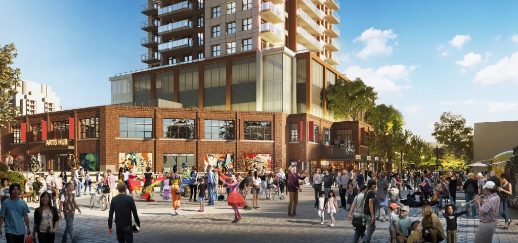 Image Source: Appelt Properties
350 Doyle Avenue Transportation Impact Assessment
350 Doyle is a proposed 25-storey, 259-rental residential unit mixed-use project in downtown Kelowna.
Our team evaluated the transportation impacts of the proposed development, reviewed existing land use and transportation conditions, forecasted future traffic conditions, reviewed zoning bylaw and site design, and presented a Transportation Demand Management strategy to support the project’s traffic and parking goals.
